South Fork Skokomish River
Class IV-V, 36fpm, 750cfs
March 30, 2003
Ben, John, Tom
The South Fork of the Skokomish is a gem. Whether you're looking for scenic Class I, scenic Class III or scenic Class V. You've come to the right place.
If you live in western Washington, you've heard tales of the annual floods. The news often shows footage of fish swimming on nearby roads. The scars are evident from the river but certainly not something you'd want to witness first hand. As the guidebook recommends, we steered cleared of the rain and arrived at the take-out on a sunny morning in late March.
The flow is difficult to judge at the gravelly take-out and put-in so one must trust the gauge, which suggested a flow slightly lower than the recommended 800cfs. Nevertheless, it was enough to get us down the first few miles of Class I. Just as you're about to doze off, you'll come to a bend in the river whose direction is not obvious. Left leads to more open valleys while right chisels it's way through deep canyons. Fortunately, the river made the right choice and we were soon presented with the first of several Class III. The first Class IV is an obvious ledge that is worth scouting from the left bank. Most of the current flows left onto rocks. We chose a boof on the right followed by a strong ferry back left to the main channel. The remainder of the first canyon can be boat scouted by going with the flow.
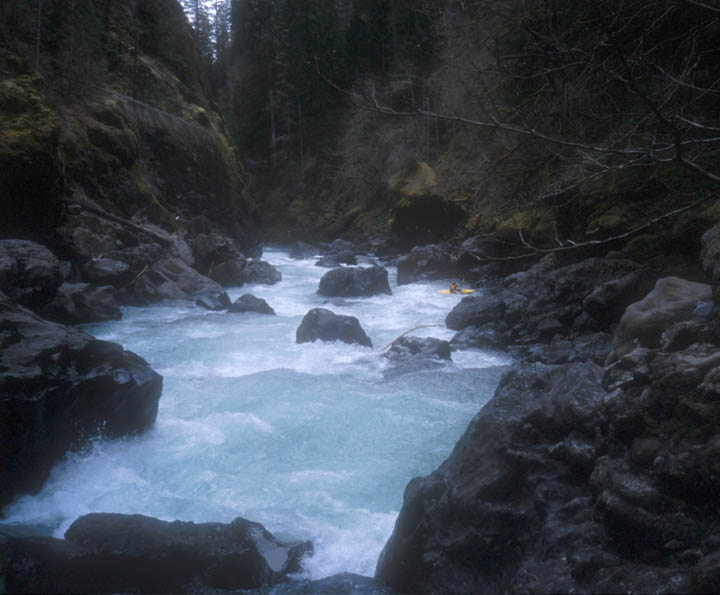
The second canyon contains the majority of the Class IV and V along with an ugly rapid that I imagine most people portage. All are fairly easy to scout but some are impossible to portage. Higher flows would make things more difficult. I did a pretty good job of capturing the highlights to I'll let the photos do the talking.
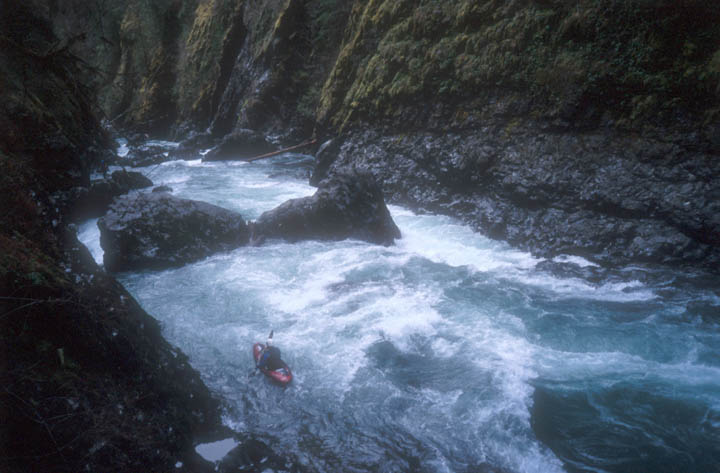
Tom at the entrance to the second canyon. Both slots go but we chose left because the hydraulic on the right didn't look too friendly. You'll want to scout the second, more difficult rapid from the boulders below on the left.

Myself running the entrance to second rapid. The log seen in the previous photo is behind me. This rapid has its share of holes and undercuts but there is a sneak route on river left so one need not worry too much. I didn't mind them at this flow.
Photographer: John
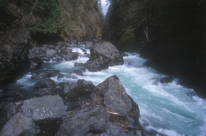
Myself running the meat of the second rapid. There is a ledge drop below here that is somewhat difficult to scout. We ended up running it far right but center looked good as well.
Photographer: John
John running one of the longer Class IV in the second canyon.
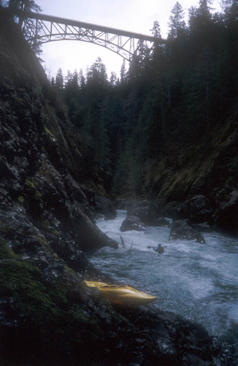
John running a rapid below High Steel Bridge.

Tom running High Steel Falls. There is a nasty hole against the wall to his left but you can avoid it by making a strong ferry to where he is now.
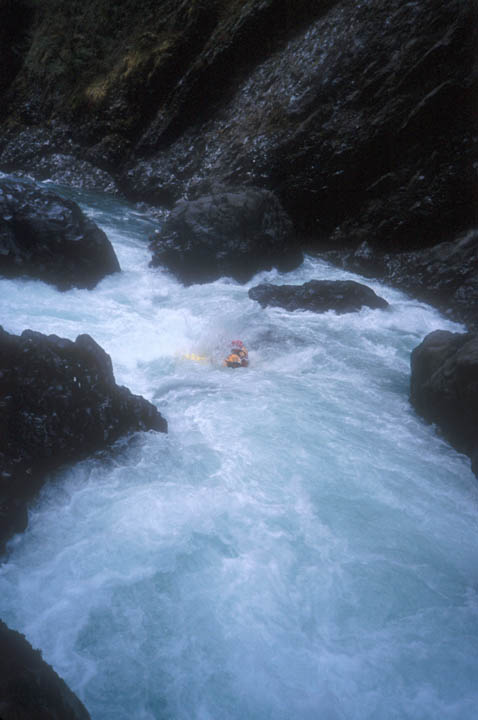
Myself midway through Bobbing for Butler. This is where things got interesting. My line was down the slide at the bottom center of the photo. Tom's line was similar only he ended up in the nasty hole at the bottom left. Yes, the boulder is undercut and he ended up swimming. He made it to the left shore fairly quickly with paddle in hand. I was left with a frantic chase down the right bank but to no avail. His boat made quick work of the remaining rapid to a cliffed in pool where it drifted into the unknown.
John portaged the slide and we met up at the base of the rapid while Tom hiked out. Our plan was to search the remaining river and meet Tom at the take-out (assuming he could make it up High Steel Bridge and get a ride down). Our frantic pace came to a halt a short distance downstream at the ugly Class V landslide rapid that the guidebook describes as a mandatory portage. A time consuming hike up and down the left bank led us to it's base where we found a rope that someone had abandoned along with more Class IV that we boat scouted with our eyes peeled for any sign of Tom's boat. We made good time to the final Class V (with the exception of a few holes that John felt obligated to surf).
Photographer: John

John surfing his way through Mr. Toad's Wild Ride, the final Class V. There is a nasty hole below John that you must go left of. The cross seen in the background made us wonder about the consequence of going right. This rapid is fairly easy to scout and portage on river left.
We never did find Tom's boat despite several miles of seemingly impassible gravel bars near the end. We figured it must have got stuffed in the landslide rapid or one of several log and boulder sieves below there. Tom returned several weeks later at lower flows and found it in a logjam that was apparently submerged during our trip. We were all thankful because it would be a shame to tarnish a good river with bad memories.
Many folks emphasize its 11-mile length but we felt no rush with a reasonably early start. The majority of the rapids can be boat scouted and the flat water goes by quickly at recommended flows. Just make sure to give yourself plenty of time to enjoy the sights because they are plentiful.